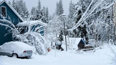
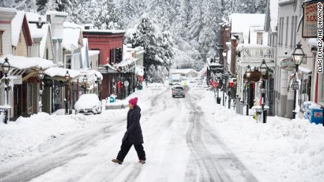
As of Tuesday, more than 202 inches of snow — nearly 17 feet — had fallen so far this month at the University of California, Berkeley’s Central Sierra Snow Laboratory, at Donner Pass east of Sacramento.
Scientists at the lab said this month is now the snowiest December on record for the location and the third snowiest month overall. The top month was January 2017 when 238 inches fell, and it’s not likely enough snow will fall in the next three days to challenge that record. Records here go back to 1970.
Lab officials said the snow was “deep and hard to get through,” and it took them roughly 40 minutes to get to where the measurements are taken just 150 feet away from the lab’s front door.
It’s a ton of snow and was much needed, but Andrew Schwartz, the lead scientist and station manager of the Sierra snow laboratory, said they are going to need more.
“While this event has been amazing so far, we are really concerned about the upcoming months not having as many storms,” Schwartz told CNN. “If we don’t get another inch, we’re still below what we would expect for the entire winter, which means that we can contribute to the drought rather than resolving it.”
As climate change accelerates and winter temperatures increase, snowfall is expected to decrease. Schwartz said he is finding that what used to fall as snow is now falling as rain.
“Ultimately, what’s happening right now in terms of climate change with our precipitation here on the summit is that we’re actually seeing increasing precipitation, but the difference is we’re seeing a reduction in snowfall and an increase in rain,” Schwartz said. “So that matches our warming signal; with that warming, we have actually moved away from some of our snowfall.”
Similarly, Schwartz said they see conditions at the summit switch from a snow-free winter to a blizzard next season. But he also said snow is clearly decreasing in the Sierra Nevada.
“And that’s really going to be what we see and what we do see frequently up here,” he added. “So as those temperatures increase, we’ll see a lot less of the stuff that we had yesterday that had us trudging out for 40 minutes.”
Record-breaking snowfall aside, Schwartz said he’s already seeing firsthand the grim consequences of the climate crisis in the Sierra Nevada.
“Overall, the trends with climate change in the region is kind of a dire one with respect to snow, because we’re not going to have it for a whole lot longer,” he said. “So when we have months like this, I’m very excited for them.”
