CNN
—
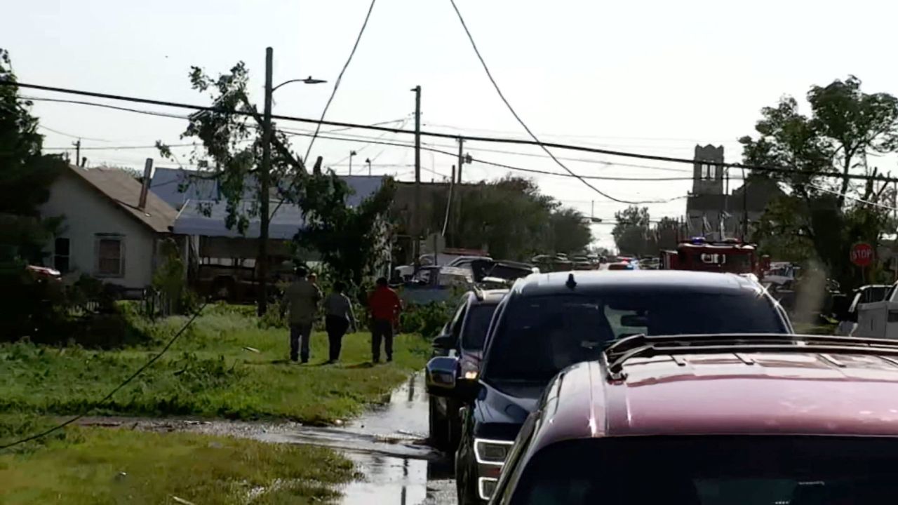
The state of Texas as well as cities and counties surrounding the Panhandle town of Perryton are sending aid after a tornado ripped through the area Thursday afternoon.
The National Weather Service in Amarillo confirmed that a tornado struck the town. Images of extensive damage have been circulating on social media.
Texas Gov. Greg Abbott’s office and the state’s Division of Emergency Management are mobilizing resources, State Rep. Four Price of District 87 said in a Facebook post.
“TDEM is moving everything that way. Search and Rescue, medical, etc.,” Price said. Multiple structures are damaged and “the state is engaging additional medical help to triage,” according to Price.
“This is a serious situation. Again, please lift that community up in prayer,” he added.
Beaver County, Oklahoma, Emergency Manager Keith Shadden told CNN the county has sent fire, law enforcement and EMS units across the state border to help. He said that they intend to send a second wave to assist but are waiting for the weather to clear in the county.
The city of Stinnett, Texas, about 56 miles from Perryton, is sending officers and EMS crews, and the Hutchinson County Sheriff’s Office posted on Facebook that they are also assisting with rescue and emergency operations following the “devastating tornado.”
The Borger Police Department, Booker Fire Department and officials with the City of Fritch are all responding to Perryton to assist with tornado damage.
CNN has reached out to local officials for more information.
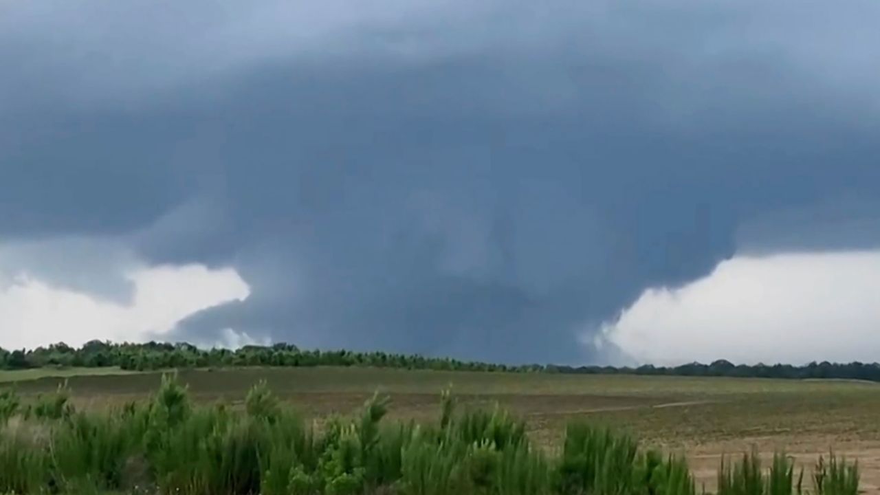
Meteorologists had warned that severe weather capable of producing wind gusts up to 90 mph, hail up to 5 inches in diameter and tornadoes was expected Thursday – the sixth day in a row for portions of the South and Plains.
The latest round of storms comes on the heels of more than 300 storm reports Wednesday, continuing a long streak of active weather.
The area under threat Thursday covers a large swath from Colorado to South Carolina, with the greatest potential across portions of Oklahoma, Kansas and Texas.
The Storm Prediction Center has placed a Level 4 of 5 moderate risk of severe weather for the area, which includes Oklahoma City and Norman, Oklahoma.
Two tornado watches have been issued by the Storm Prediction Center for western and central Oklahoma and portions of northwestern, northern and central Texas. The watches include the Dallas-Fort Worth Metroplex and Oklahoma City and both are in effect until 10 p.m. CT.
“Intense supercell development is expected this afternoon from the eastern Texas Panhandle into western Oklahoma and northwest Texas, and storms will spread eastward through late evening,” the SPC said. “The initial, more discrete supercells will be capable of producing giant hail (4-5 inches in diameter) and a few tornadoes. Upscale growth into a cluster or two is possible this evening, with an increasing threat for intense outflow winds of 80-90 mph.”
Extremely large hail is another threat.
“Be prepared for hail up to the size of baseballs and winds up to 80 mph with the stronger storms, as well as a medium risk for tornadoes,” warned the National Weather Service office in Norman. “The severe window will start in western Oklahoma between 3pm and 5pm and continue until storms exit the southeastern parts of the forecast area by 3am.”
Know the difference between a tornado watch vs tornado warning
Areas around the Dallas-Fort Worth Metroplex are under a Level 3 of 5 enhanced risk of severe weather.
“The areas most susceptible to another round of large hail and possibly some damaging winds will be eastern North TX down into far eastern Central TX east of I-45 could get into the mix as well,” the weather service office in Dallas said.
A much broader area of severe weather extends from western Kansas, south to central Texas and east to the Florida Panhandle. The Level 2 of 5 slight risk of severe weather covers more than 10 million people and includes places like Tulsa, Oklahoma; Shreveport, Louisiana; and Tallahassee, Florida.
Lastly, a widespread area of a Level 1 of 5 marginal risk of severe weather covers from eastern Colorado to South Carolina.
While it is not in the main threat area, people should not let their guard down because of the potential for damaging winds and very large hail. An isolated tornado could spin up as well.
In addition to the severe weather threat, the same areas should also monitor the potential for flooding. With days of rain over the same areas, the ground is becoming quite saturated.
“A continued threat of heavy rain through the day with potential for several inches to fall within bands of training convection,” is being warned by the weather service office in Mobile, Alabama.
The multiday severe threat will continue Friday and through the weekend, as storms continue to develop each day along a stalled frontal boundary draped across the South.
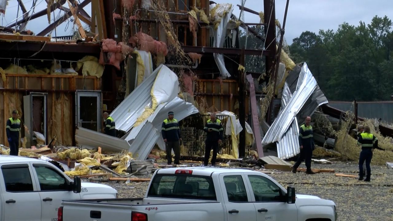
Wednesday’s severe threat brought more than 300 storm reports across the South and Plains.
There were at least 100 hail reports and more than 200 wind reports, which knocked out power to more than 100,000 homes.
Baseball to tennis ball-sized hail was reported in Alabama and hail greater than 5 inches was reported in Mississippi.
Of the 10 tornado reports, five were reported in Georgia, two in Texas and three in Alabama.
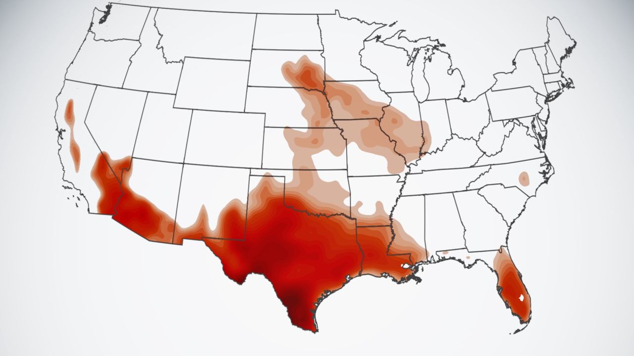
Not only will millions face severe weather, but more than 30 million people are also under heat alerts, including large portions of Texas, Louisiana, Mississippi and South Florida.
Most will see temperatures running at least 10-15 degrees above normal, with the potential for nearly 100 high temperature records to break during the next week.
Texas is expected to get hit exceptionally hard, with heat indices reaching as high as 120 degrees.
Heat indices are the “feels like” temperature, when you factor in the humidity.
The Texas power grid could reach a record high for usage next week, as temperatures stay in the triple digits for at least the next week.
