Mauna Loa, Hawaii
CNN
—
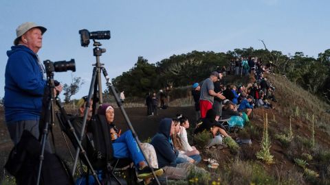
Since Hawaii’s Mauna Loa began erupting last week, photographer CJ Kale has sacrificed hours of sleep, rising before dawn to catch the volcano against the sunrise and working late into the night to capture its magnificent glow.
For years, Kale has been going to extraordinary lengths to photograph volcanic events, including swimming just feet from flowing lava as it cascaded into the ocean. He is among a handful of self-proclaimed “lava junkies” who are willing to put themselves at risk to witness volcanoes up close.
“It’s kind of our fix,” he said. “It’s what gives us our excitement. It’s what gives us our adrenaline for the day.”
As a longtime lava chaser, he knows his threshold for what is possible has grown higher than most. “There’s definitely a range (of lava junkies) and my group of friends is definitely the far outer limits of that range. We push a little far, yeah, but I wouldn’t recommend pushing it far for everybody.”
While no communities are currently at risk, scientists and island officials are keeping a careful eye on the eruption’s movements. For those who try to venture close to the lava flow, however, the situation can be unpredictable.
As the slow-moving flow is advancing, its edges can cool into a rough, spiny surface which may seem secure, but its core still contains molten lava, Cheryl Gansecki, a geologist at the University of Hawai’i at Hilo who is studying the eruption, told CNN.
“It might just look like a big wall of hot rock and it doesn’t look like it’s moving much, but they can surge where all of a sudden the front breaks off and lava comes spewing out.”
Due to the eruption hazards, including dangerous gases and volatile conditions, the Hawai’i Volcanoes National Park has closed the volcano’s summit and high elevation areas, as well as some nearby roads. Visitors are still able to see Mauna Loa – and its erupting sister volcano Kilauea – from several park overlooks and a viewing road that was opened along the Daniel K. Inouye Highway.
But for Sherry and Curtis Grumbles, that’s nowhere near close enough.
The couple made a round-trip trek of four hours to see the towering head of Mauna Loa’s lava flow. They stood just yards from the crawling tidal wave, they said, describing the sound of bursting lava as like shattering glass.
“You get a feeling of awesomeness, of how much power is coming,” Curtis Grumbles said. “There’s a two-story wall of lava just inching towards you, and you know there’s no way that anything’s going to stop it.”
The area technically is government property. It’s not only illegal to be there during closures, but dangerous because of unexploded military ordnance.
Despite the known risks, the pair plans to hike the lava field again at night to see the “dramatic glow.”
“You know, you can live caged up and have a pretty boring life or you can go see for yourself and take the chance and enjoy your life,” Sherry Grumbles said.
Meanwhile, researchers with the US Geological Survey are making calculated visits to the eruption site. Clad in flame-resistant clothing, heavy boots and gloves, they carefully gather lava samples that may be key to learning what moves the eruption could take next.
After “quenching” the lava samples in water, researchers bag them up and send them to the University of Hawai’i at Hilo where Gansecki and her colleagues are able to quickly extract valuable data that can help the agency model future behavior.
“The composition of the lava can affect things like flow rates, so understanding rapidly what is in the rock can help predict how that flow is going to react in the real world,” said University of Hawai’i anthropologist Peter Mills.
In pictures: Mauna Loa volcano erupts in Hawaii
The molten flow is currently creeping forward at an average pace of less than 20 feet per hour, according to the US Geological Survey. It has been inching closer to the Big Island’s major Daniel K. Inouye Highway for days, though it is still about 1.8 miles from the roadway, the agency said.
Currently, no homes or businesses are threatened, but island officials and researchers are using the modeling to detect any developments that could cause communities to be at risk.
“We’re kind of the first line of defense,” explained university geologist Steve Lundblad. “We can get information that’s quite good right away.”
Residents of the Big Island have experienced the devastation of volcanic eruptions as recently as 2018, when Kilauea – a much smaller volcano sitting on Mauna Loa’s southeastern flank – erupted for months, destroying more than 700 homes in the Leilani Estates neighborhood and displacing residents.
Kale lost property in the 2018 eruption, and his mother has also had a property destroyed. But to Kale and many other residents, the risk is just a fact of life on the Big Island.
“We don’t view it as loss. We view it as borrowed time,” he said. “We have this special time in this moment in this area that’s close to the volcano. And as much time as she gives us, that’s how much time she gives us.”
