Severe weather is expected to continue to move over the northeastern U.S. this week, as heavy snow from a winter storm spreads into New England.
The National Weather Service’s Weather Prediction Center said Wednesday that the system is forecast to track through the eastern Great Lakes overnight, with snow changing into a wintry mix by early Thursday.
Strong winds of up to 50 mph are possible over some locations in southern New England and the Gulf of Maine, with travel conditions predicted to be affected.
This comes after the storm produced heavy snow from the middle Mississippi Valley and Great Lakes to the Northeast on Wednesday.
SEVERE WEATHER THREAT MOVES EAST AFTER TORNADOES HIT TEXAS
A person walks along North Shore Beach on a snowy day Wednesday, Jan. 25, 2023, in the Rogers Park neighborhood of Chicago.
((AP Photo/Erin Hooley))
“Snow, sleet, and freezing rain will affect travel through the area. The system is forecast to move out of the area by Thursday evening,” the agency said in a tweet.
On Wednesday, heavy, wet snow – part of a system that formed tornadoes in Texas – hit Indiana and Michigan.

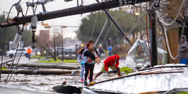
People cross under downed power lines where a tornado was reported to pass along Mickey Gilley Boulevard near Fairmont Parkway, Tuesday, Jan. 24, 2023, in Pasadena, Texas.
((Mark Mulligan/Houston Chronicle via AP))
Fort Wayne, Indiana, saw numerous crashes on snow-covered roads and some power outages were reported in Hamilton County.
TEXAS TORNADO AFTERMATH: VIDEO CAPTURES SCENES OF DEVASTATION IN DEER PARK, OUTSIDE HOUSTON

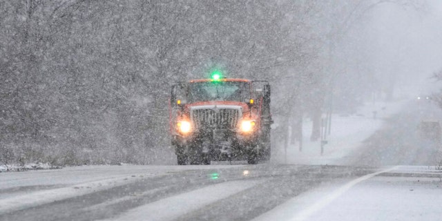
A Wayne County Department of Public Services truck salts a road, Wednesday, Jan. 25, 2023, in Wayne, Michigan.
((AP Photo/Carlos Osorio))
Schools and businesses were closed in Oklahoma on Wednesday and outages were reported in Arkansas and Missouri.
Winter weather advisories were in place from Missouri to Maine, and forecasters said the storm would bring damaging winds to parts of Florida, Georgia and the Carolinas.

A seagull stands on Columbia Beach on a snowy day Wednesday, Jan. 25, 2023, in the Rogers Park neighborhood of Chicago.
((AP Photo/Erin Hooley))
The NWS in Chicago warned early Thursday that people should take extra care on “slippery” roads.
CLICK HERE TO GET THE FOX NEWS APP
Tracker PowerOutage.US showed that more than 55,000 customers in Arkansas and more than 20,000 in Missouri were still without power. More than 11,000 were in the dark in Maine.
Fox Weather reported that the winter storm would move out of the country on Thursday.
The Associated Press contributed to this report.