Some of the most fascinating, historic shipwrecks that lie on the ocean floor off the coast of Massachusetts need to be protected, so researchers can “build upon successes” that started in 2019, federal authorities said this week.
The National Oceanic Atmospheric Administration (NOAA) warned boaters and fishermen to keep 400 feet away from known wrecks in the Stellwagen Bank National Marine Sanctuary, an 842-square-mile marine protected area at the mouth of Massachusetts Bay between Cape Ann and Cape Cod.
Gear caught on the underwater wrecks could “cause serious damage to shipwrecks that have historical significance,” NOAA said.
There are more than 200 wrecks in the sanctuary, according to NOAA, which specifically mentioned the World War II minesweeper USS Heroic, the trawler Josephine Marie and the 55-foot North Star, along with eight unnamed ships with their coordinates.
NY PET ALLIGATOR SEIZED BY STATE ‘LIKE THEY WERE RAIDING A TERRORIST’S HOME’: OWNER
Divers explore the WWII minesweeper USS Heroic off the coast of Massachusetts. (NOAA)
The shipwrecks are protected under the National Historic Preservation Act and the National Marine Sanctuaries Act, according to NOAA.
During a 2019 expedition, researchers explored the steamship Portland, which sank in November 1898 and killed all 130 people on board.
1,800-YEAR-OLD ARTIFACT UNEARTHED DURING ROUTINE CONSTRUCTION ‘A COMPLETE MYSTERY’
“The ship is often called ‘The Titanic’ of New England’; due to its long-unknown location, the large loss of life, and its luxurious design,” NOAA said in its description. “Portland’s remnants are considered the best preserved of the New England ‘night boats’ yet located.”
“Its sinking during The Portland Gale of 1898 lent its name to the storm. The wreck was the first of the sanctuary shipwrecks to be listed on the National Register of Historic Places.”
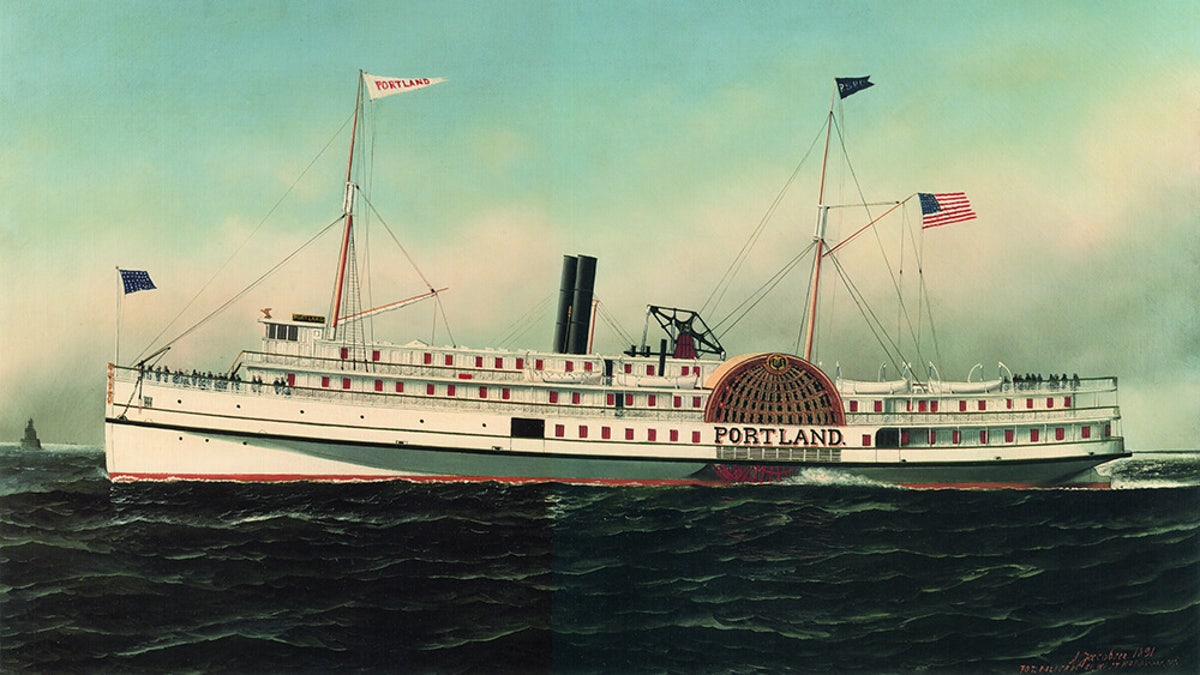
The steamship Portland sank off the coast of Massachusetts in 1898. ( Art: Courtesy of Marine Historical Society/NOAA)
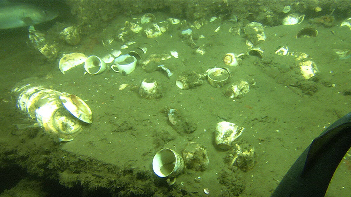
Plates and cups from the steamship Portland’s wreckage. (NOAA)
The only other two listed wrecks named by NOAA are the trawler Josephine Marie and the 55-foot North Star.
The Josephine Marie was a steel-hulled trawler that was built in 1969. It hit an object and sunk on February 1, 1992, according to NOAA.
MALAYSIA AIRLINES FLIGHT MYSTERY: FORMER NTSB INVESTIGATOR INTRODUCES NEW THEORY ABOUT MISSING PLANE
All four crew members aboard died. It was discovered upside down and about 105 feet underwater.
“The bow and rudder areas along with exposed piping provide habitats for marine life like sponges, anemones, and various fish,” NOAA said. “The currents are swift around the site, therefore dives need to be timed to slack water.
“There is also fishing gear that divers need to be aware of as possible dive hazards.”
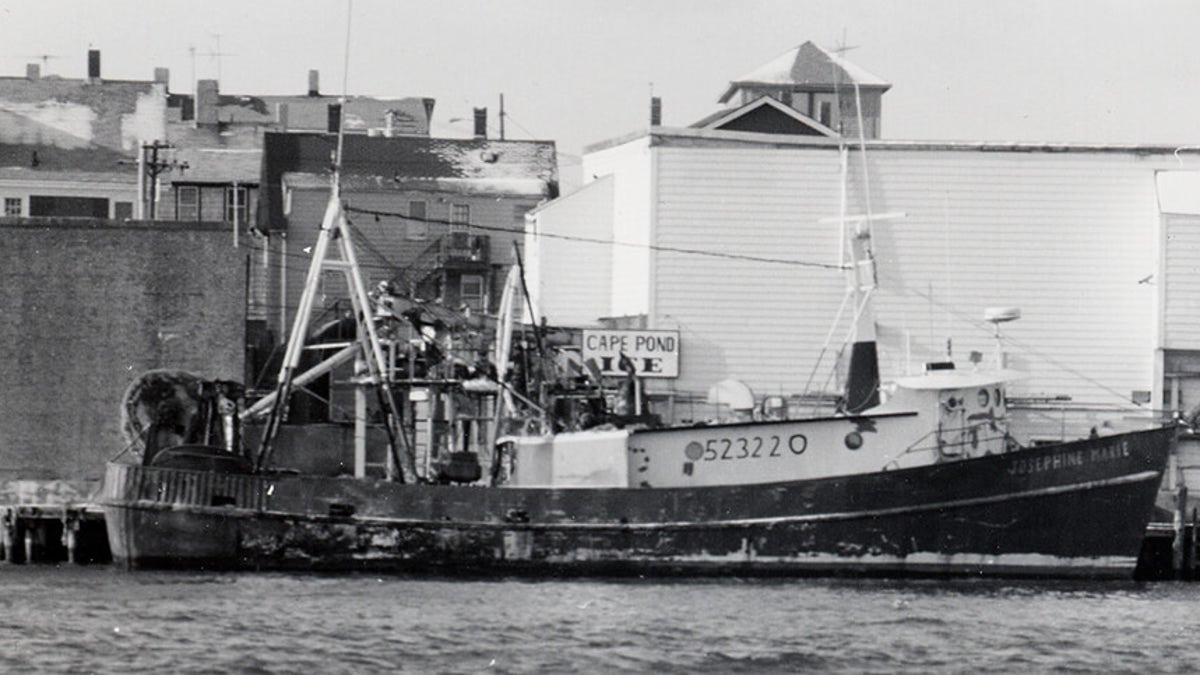
The trawler Josephine Marie sank on February 1, 1992. (Courtesy of John Harper/NOAA)
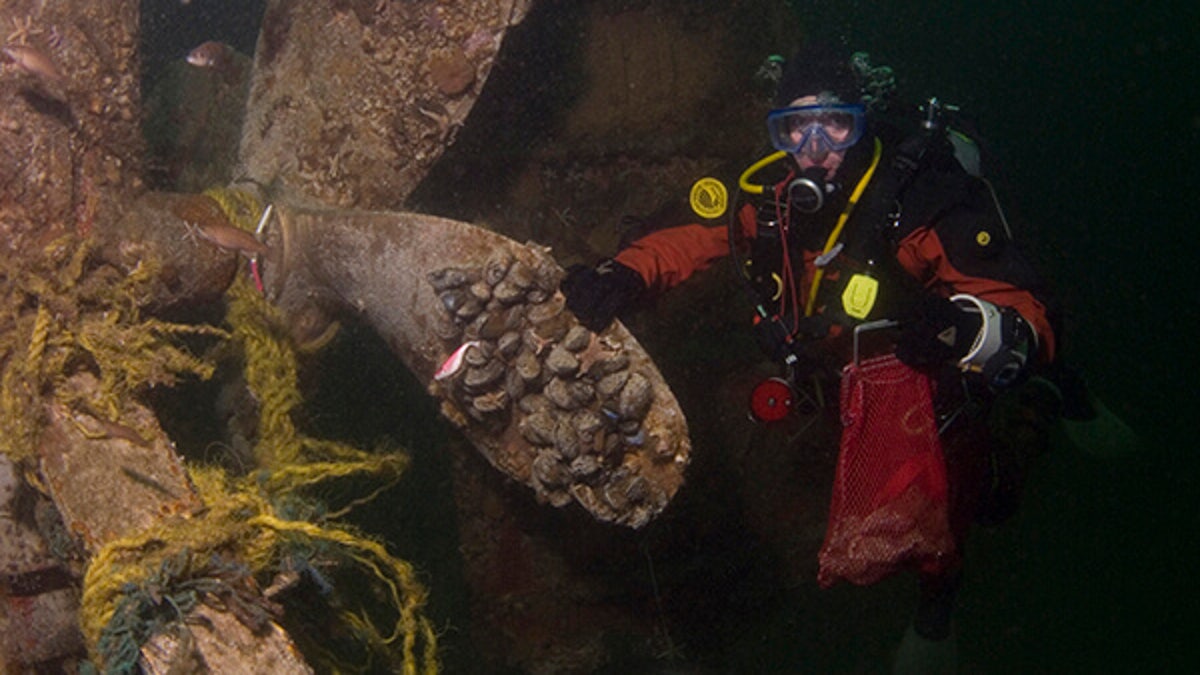
The propeller of the trawler Josephine Marie, which sank 105 feet underwater, upside down. (NOAA)
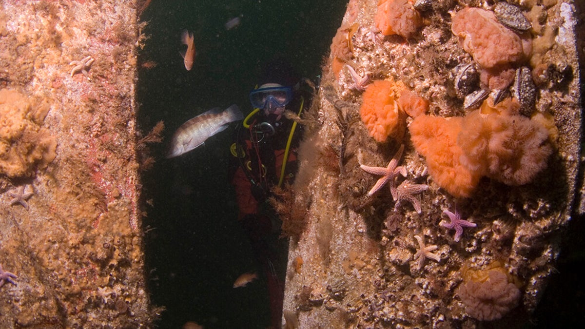
“The currents are swift around the site, therefore dives need to be timed to slack water,” according to NOAA. (NOAA)
The final named wreck is the North Star, a 1967 rig dragger that sank on August 28, 2003, after it capsized. The two crew members aboard died.
The vessel broke into three pieces when it sank. The hull was at the dive site’s north end, the clam dredge fell about 100 feet away, and the deck machinery was found west of the dredge and still connected by its towing cable, according to NOAA.
“The shipwreck sat on a sandy bottom that was actively fished,” NOAA wrote in its history of the ship. “It appears that scallop gear may have significantly moved and damaged the pieces of the wreck.”
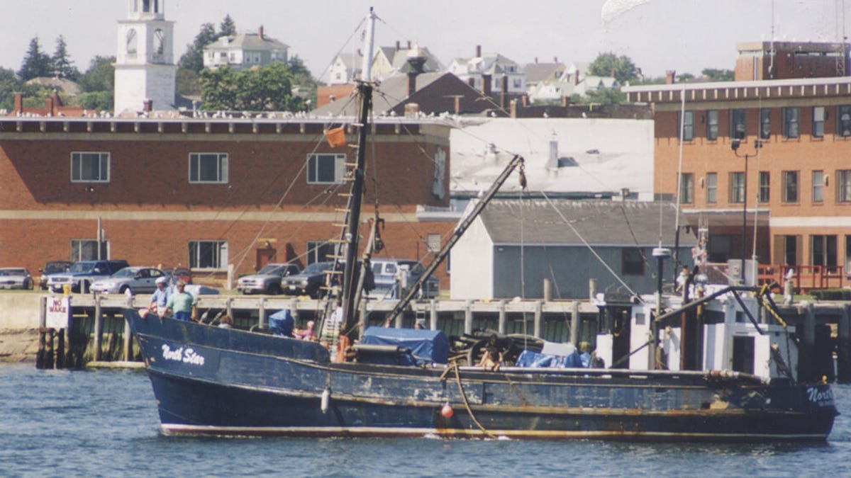
North Star in the Gloucester Harbor before it capsized. (Len Parker Collection, Maritime Gloucester/NOAA)
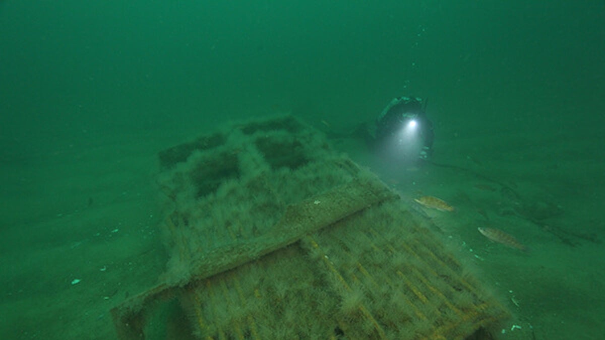
The clam of the rig dragger North Star’s size dwarfs the diver. (NOAA)
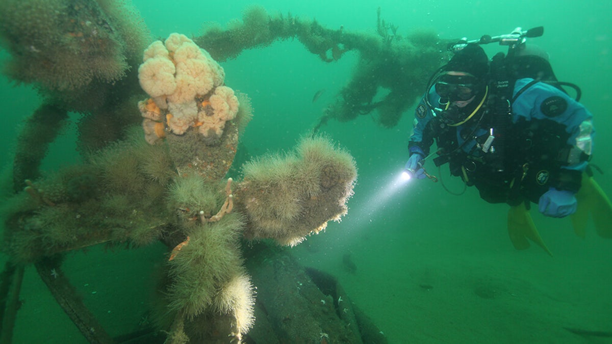
A diver inspects the North Star’s propeller. (NOAA)
Since the initial dive in 2019, researchers have been studying ocean life and how it interacts with the wreckage, while preserving the “time capsules” to honor those who died when the ships settled over 100 feet underwater.
There are an estimated 200 wrecks in the 842-square-mile area. So far, 47 have been documented, 12 of which have been identified, according to NOAA.
AMELIA EARHART PLANE CRASH: AIR FORCE VET IS ‘CERTAIN IMAGES ARE HISTORY’S MOST FASCINATING WRECK’
The steamboat Portland is the most iconic and best studied wreck, in large part because of its massive loss of life and the grandiose nature of the ship.
“In addition to exploring the wreck of Portland, the research team will be working to solve a maritime mystery,” NOAA said on its website. “In 2003, sanctuary scientists located a new shipwreck, dubbed the ‘mystery coal schooner.’
“In the 19th and 20th centuries, schooners carried coal to heat homes, power factories, and fuel railroads,” according to the NOAA, which added that “researchers hope to learn the identity of the mystery coal schooner through the combination of high resolution imagery of the entire wreck and historical research.”
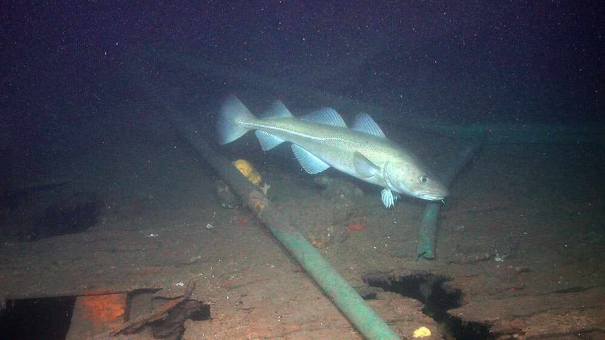
The shipwreck of the steamship Portland is home to a variety of marine life. (WHOI/NOAA)
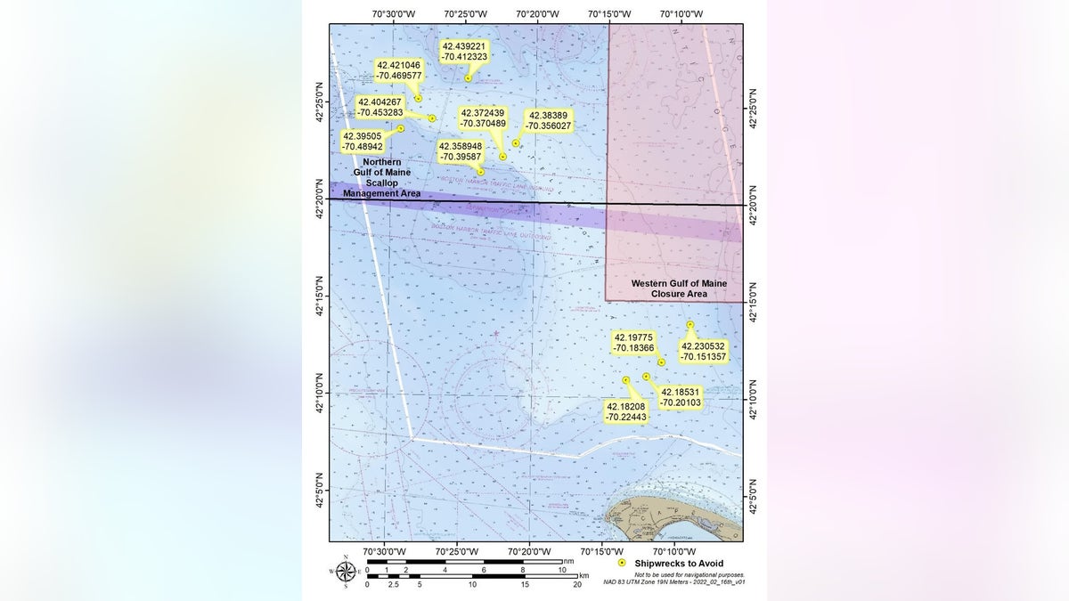
Map of the Stellwagen Bank National Marine Sanctuary off Massachusetts, where over a dozen historically relevant ship wreckages are being explored. (NOAA)
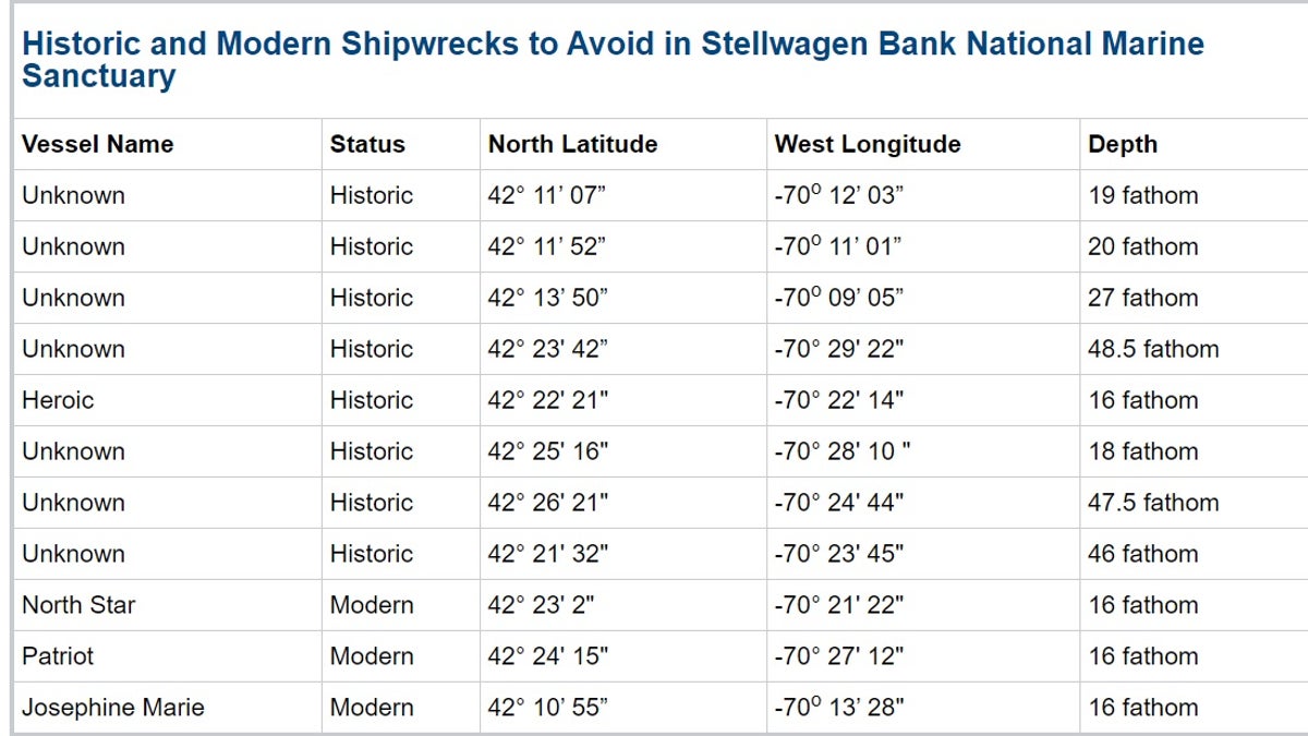
NOAA provided the coordinates to 11 specific shipwrecks in the map of the Stellwagen Bank National Marine Sanctuary off Massachusetts. (NOAA)
Besides the interest in the physical wrecks, researchers are studying the scope of marine life.
“Shipwrecks are underappreciated as habitats, but they host abundant biological communities,” Kirstin Meyer-Kaiser, the lead scientist for the project, said in a statement last year. “This project is designed to shed light on wrecks as habitats, answer some of our scientific questions and help preserve them for years to come.”
CLICK HERE TO GET THE FOX NEWS APP
Since 2019, the sanctuary has been exploring the wreck with Woods Hole Oceanographic Institution and Marine Imaging Technologies, collecting video imagery to develop virtual 3-D models, studying the invertebrate community, and bringing the excitement of underwater research to the public via real-time broadcasts.