CNN
—
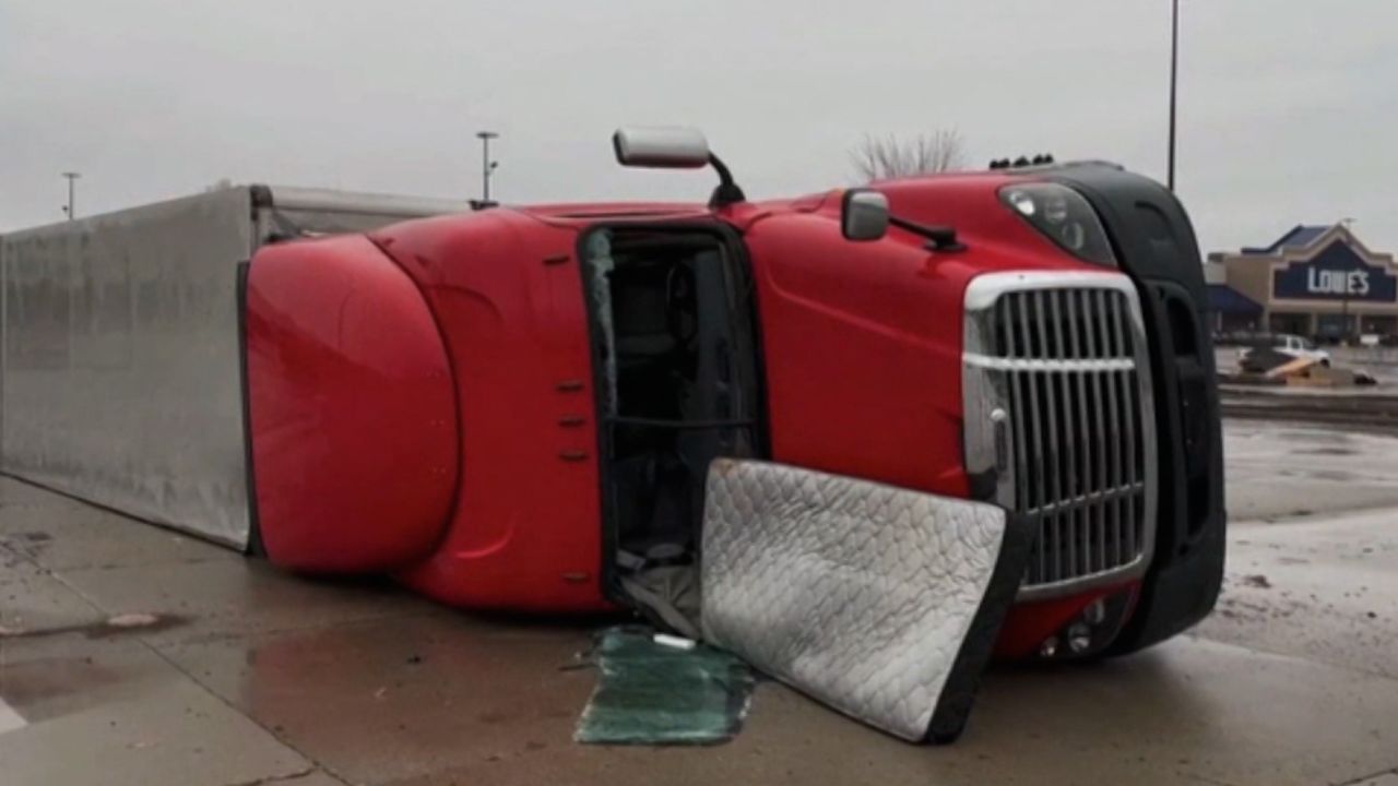
A storm system on Tuesday evening was bringing severe weather including tornadoes, large hail and strong winds to states from the South to the Upper Midwest, including areas devastated by recent tornadoes.
There were more than 100 reports of hail by about 10 p.m. ET, according to the National Weather Service’s Storm Prediction Center. There were five preliminary tornado reports, the agency said.
Two people were evacuated from a gas station in the northwest Illinois town of Colona after a tornado struck there Tuesday morning, police said.
The tornado has been rated as an EF2 with an estimated peak wind of 115 mph, the weather service said.
“The major center of damage from today’s storm was Shell Gas station and the building directly behind it,” according to the Colona Police Department. “There are no injuries reported at this time.”
Forecasters said they were concerned especially dangerous nighttime tornadoes could strike parts of Arkansas, Oklahoma and southern Missouri overnight – potentially causing more destruction in areas already pummeled by last week’s deadly tornadoes and storms that killed 32 people.
Tornadoes that strike in the middle of the night are often deadlier than twisters that hit during daytime hours because people are less likely to get weather alerts when they’re asleep, research shows.
The first round of storms started in the afternoon, dropping very large to giant hail, according to the Storm Prediction Center. Davenport, Iowa, reported 4-inch hail – just larger than a softball – while Oswego and Aurora, both western suburbs of Chicago, saw baseball-sized and pool-ball-sized hail, respectively.
“Worst hail I’ve ever heard in Davenport,” Paul Schmidt wrote on Facebook, saying he worried about the condition of his home. “Sounded like bricks hitting the roof.”
About 3 million people were under a tornado watch in parts of Illinois, Iowa and Missouri until 10 p.m. CT, according to the National Weather Service, bringing the threat of tornadoes, widespread large hail and wind gusts of up to 70 mph. The area includes cities like Des Moines and Cedar Rapids, Iowa, and Columbia, Missouri.
The Storm Prediction Center said a Level 4 storm risk area, which means long-lived, “widespread and intense” storms are likely, included southern Missouri and parts of Arkansas and Oklahoma. The area included just over 1.2 million residents.
More than 9.5 million people live in a Level 3 of 5 risk area that includes St. Louis; Madison, Wisconsin; Aurora, Illinois; Des Moines, Iowa; and Little Rock, Arkansas – which was ravaged by a violent tornado Friday. A Level 3 risk means numerous severe storms are possible, and some may be intense.
“Weather conditions in these areas could be life-threatening at times, and those in affected areas should pay close attention to the local NWS Weather Forecast Office for Advisories, Watches, and Warnings,” the Weather Prediction Center warned.

More than 50 tornadoes touched down in several states Friday and Saturday, obliterating houses and leaving communities wondering how they’ll recover.
South Dakota is facing a different kind of extreme weather. More than 140 miles of the Interstate 90 and about 85 miles of I-29 are closed indefinitely due to blizzard conditions, according to an alert on the state’s Department of Transportation website.
The closure affects I-90 from Rapid City to Murdo and I-29 from Watertown to the border with North Dakota, the department said.
“Accommodations at Murdo are limited. Adjust travel plans and seek shelter elsewhere. Expect multiple day closures,” the alert warned.
US 12 near Summit, South Dakota, is “solid ice and hard to even walk on,” according to the highway patrol. “We need our citizens and visitors help to make sure everyone stays safe during this storm. US 12 westbound from Summit is impassable and more and more vehicles keep getting stuck there.”
The highway patrol asked people to stay home but if not, “be prepared in case you get stranded.”
The National Weather Service issued a blizzard warning and a winter weather advisory for the affected areas.
More than 11 million people from southeastern Arizona to southeastern Nebraska are under red flag warnings Tuesday.
According to the National Weather Service, red flag warnings are issued when warmer temperatures, low humidity, and strong winds are anticipated to combine to increase the risk of fire.
Fires could be fueled by dry surface air, breezy winds, dead grass and brush and warm temperatures,” the weather service office for Omaha and Valley, Nebraska, said.
An “extremely critical” Level 3 of 3 fire risk is in place across parts of eastern New Mexico, western Texas, western Oklahoma and southern Kansas. This area includes the Texas cities of Lubbock, Amarillo, Midland and Odessa; and the New Mexico city of Clovis.
“Dangerous fire weather conditions are expected on Tuesday with potential for multiple large, dangerous, and fast moving fires,” the weather service said. “Extreme caution should be used to avoid sparks and open flames.”
A broader Level 2 “critical” risk encompasses the Level 3 area and extends from the Texas-Mexico border to southwestern Iowa, including Oklahoma City and Norman in Oklahoma, Wichita in Kansas, and Abilene and Wichita Falls in Texas.