Winds behind the nor’easter could gust as high as 40 mph in some locations this morning.
“These strong winds, combined with the cold air temperatures will cause wind chills (or the “feels like” temperature) to be as cold as 10 to 20 degrees below zero,” CNN meteorologist Haley Brink said Sunday.
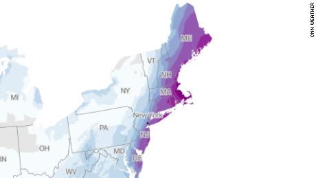
Afternoon high temperatures will remain below average across the Northeast on Sunday, with most locations struggling to get above 30 degrees.
About a million people across the Northeast were under winter weather alerts early Sunday, down from the nearly 16 million who were affected by such alerts Saturday night.
“That is a huge drop-off as the storm exits the most populous areas of the eastern seaboard,” CNN meteorologist Derek Van Dam said.
A blizzard, as defined by the NWS, requires blowing or falling snow, winds of at least 35 miles per hour, and visibility of a quarter mile or less for at least three hours.
Wind speed — which reached more than 80 mph Saturday across eastern Massachusetts — is expected to ease to about 15-25 mph Sunday, though gusts could be higher in some local areas, according to Van Dam.
Later Sunday, some areas including Buffalo, New York, and Pittsburgh will see temperatures improve by roughly 10 degrees.
Meanwhile, cities including New York, Boston and Philadelphia will see a slight dip of about 4 degrees Sunday.
“Although temperatures are going to rebound (Sunday), we will have to be patient for any real warm up, which doesn’t come until the middle of the week,” Van Dam said.
The frigid cold follows dense snowfall that broke records throughout the Northeast in parts of southern New Jersey, New York, Pennsylvania and Massachusetts.
The storm wreaked havoc on transportation in the region, creating dangerous conditions on roadways and delays and cancellations on air and rail travel.
Record snow and roaring winds

The bomb cyclone brought heavy snow that accumulated quickly as howling winds blew through the region.
Here are some notable snowfall records:
- Atlantic City, New Jersey: The city crushed its all-time January snowfall record by Saturday, reaching a monthly total of 33.2 inches of snow. The prior monthly record of 20.3 inches was set in January 1987. The city’s 14 inches of snow Saturday also beat its previous record for the calendar date, which was set in 2014 at 7.3 inches.
- Boston: Logan International Airport tallied at least 23.6 inches of snow by Saturday night, said the NWS, making Saturday the snowiest January day Boston has recorded and tying the record for biggest 1-day snowfall total. The previous record was set on January 27.
- Central Park, New York: The iconic park saw 7.3 inches on Saturday, beating the previous record for January 29 of 4.7 inches set in 1904.
- Philadelphia: The city was hit with 5.8 inches of snow Saturday, beating the previous calendar day record of 5 inches set on January 29, 1904.
Freezing temps and no electricity
The storm’s strong winds lead to downed power lines, leaving thousands without power in the brutal cold.
At least 60,861 Massachusetts customers are still without power Sunday morning, according to the Massachusetts Emergency Management Agency (MEMA).
Most of Massachusetts’ remaining outages are on Cape Cod and along the southern coastline, according to MEMA’s map.
High winds and snow pushed over several trees across Nantucket Island while some areas were out of power because of downed wires, island Fire Chief Stephen Murphy told CNN Saturday afternoon. Several roadways were also closed because of flooding, the chief said.
“We do have coastal flooding when we get these kinds of storms, but today was pretty intense,” Jason Graziadei, an editor at the local newsletter Nantucket Current, told CNN. “People (are) kind of just hunkering down out here.”
In the coastal Massachusetts town of Marshfield, town administrator Michael A. Maresco about 4 feet of water came over the seawall at high tide Saturday.
CNN’s Haley Brink, John Keefe, Jason Hanna, Christina Maxouris, Brynn Gingras, Brian Todd, Artemis Moshtaghian, Liam Reilly, Tyler Mauldin and David Williams contributed to this report.
