CNN
—
A dramatic change is on the way as a robust cold front delivers the first hefty dose of fall weather by the weekend, sending temperatures tumbling by as much as 35 degrees.
The cooldown is welcome news for millions in the South that have endured a brutally hot summer and a roasting start to fall.
Relief from the heat will make it as far south as the Gulf Coast. States like Louisiana — which endured its hottest summer on record this year — will have below-normal afternoon temperatures for the first time since spring.
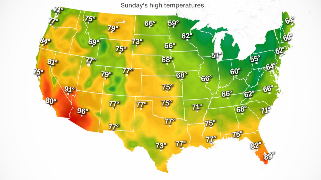
The change will begin in portions of the Plains and Midwest that have been baking in record-breaking October heat since Saturday. Dozens of daily temperature records have fallen there, and some cities in Minnesota and Michigan smashed all-time October temperature records.
While the most brutal heat will soon come to an end across the north-central US, summerlike heat is only beginning to build for the Northeast. Temperatures 10 to 15 degrees above normal October levels will be common through Thursday across the Great Lakes and Northeast.
It won’t last for long. The coldest air of the season will arrive late this week and usher in conditions that haven’t been felt since early May across the northern US.
A one-two punch of cold air from two separate cold fronts will surge across the central US starting Wednesday and expand into the eastern US Friday and through the weekend.
High temperatures from the Great Lakes to New York could drop by as much as 35 degrees by the weekend. Temperature drops of 20 degrees will be more widespread.
The first cold front will bring relief to states in the north-central US from Wednesday to Thursday. Places like Minneapolis, where record-breaking temperatures soared into the 90s on Sunday, may not make it out of the 60s on Wednesday.
The second cold front will be much more potent and usher in the season’s first push of truly autumn air for the central and eastern US. Chilly, Canadian air will surge southward as the cold front digs across the eastern two-thirds of the continental US from Thursday to Sunday.
Places like Detroit and Cleveland – that soar into the upper 80s on Wednesday – may not climb out of the low 50s on Sunday. Philadelphia and New York City will likely bask in the 80s through at least Wednesday, but by Sunday, high temperatures will struggle to reach the low 60s.

Overnight low temperatures will also plummet behind these fronts.
Low temperatures in the upper 30s to low 50s are likely across the north-central US and Midwest by Saturday morning, and in the Northeast by Sunday morning.
The first frost of the season is possible for portions of northern states like North Dakota, Minnesota and Wisconsin as temperatures drop into the low to middle 30s.
Chilly fall weather should stick around early this month, especially in the eastern US. Below-average temperatures are likely from the Gulf Coast into the Northeast through at least the middle of next week, according to the Climate Prediction Center.
Rain and storms to accompany fronts
The dramatic cooldown won’t be the only noticeable weather change this week. The clash between cold, autumnal air and steamy, summerlike air will create stormy weather.
The storm threat on Wednesday will stretch from the southern Plains to the Midwest. Some storms may turn severe on Wednesday afternoon, mainly in Texas and Oklahoma.
Any rain from these storms is sorely needed in Texas, where 80% of the state is experiencing at least moderate drought, according to the US Drought Monitor. From Tuesday through Wednesday, 0.75 to 1.50 inches of rain could fall across much of the state, with higher amounts possible in areas worked over by multiple storms.
Rain and thunderstorms will continue to march slowly eastward and impact portions of the eastern US Thursday and Friday, while wet weather continues in the Midwest.
Periods of heavy rain are possible the Northeast over the weekend. Any heavy rainfall could pose an issue for parts of the region plunged underwater by flooding rainfall last week.