The Nor’easter that brought feet of snow and near-hurricane-force wind gusts has moved on, but we’re still dealing with heavy snow for parts of the upper Great Lakes and colder air and breezy conditions behind it.
WINTER STORM BRINGING WEATHER HAZARDS TO NORTHEAST, NEW ENGLAND
Top snow reports
(Credit: Fox News)
A big temperature swing is expected to happen for the Plains, with above-average daytime highs Tuesday and much cooler air moving in later this week.
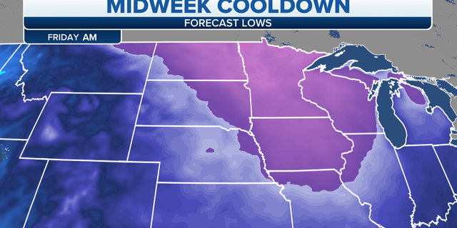
Plains midweek temperatures
(Credit: Fox News)
A cold front on Wednesday is bringing the risk for strong-to-severe storms for parts of the South and then the risk of freezing rain and/or ice for parts of the Tennessee and Mississippi valleys.
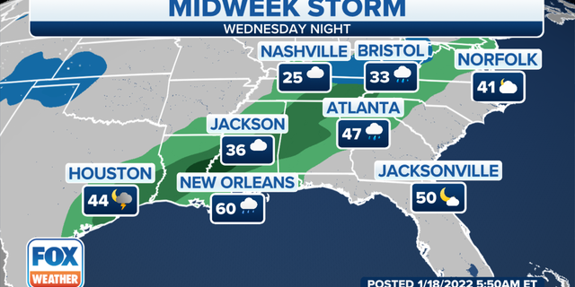
South midweek storm
(Credit: Fox News)
CLICK HERE TO GET THE FOX NEWS APP
The southern Plains will also be at risk for wildfires to start and spread with dry, windy and warm conditions ahead of the next cold front.
