Hurricane Ian has its sights set on the Carolinas.
After restrengthening into a Category 1 storm, the hurricane is expected to bring life-threatening storm surge and hurricane conditions to the region by the afternoon.
The National Hurricane Center said landfall was expected by that time.
Early Friday, the Category 1 storm was located about 145 miles south-southeast of Charleston, South Carolina.
Maximum sustained winds were reported at 85 miles per hour, with higher gusts.
Hurricane-force winds extend outward up to 70 miles from the center and tropical-storm-force winds extend outward up to 485 miles.
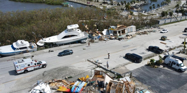
Damaged boats lie on the land and water in the aftermath of Hurricane Ian, Thursday, Sept. 29, 2022, in Fort Myers, Florida.
(AP Photo/Wilfredo Lee)
Hurricane Ian was moving toward the north-northeast near 9 mph and a turn to the north is expected Friday morning.
Fox Weather said a two-foot storm surge was being reported in Jacksonville, Florida, with additional impacts in other parts of northeastern Florida.
The hurricane center warned that life-threatening storm surge would lash the coasts of that part of Florida, Georgia and the Carolinas within storm surge warning areas, and hurricane-force winds are expected along the South Carolina and southeastern North Carolina coasts within the hurricane warning area by the afternoon.

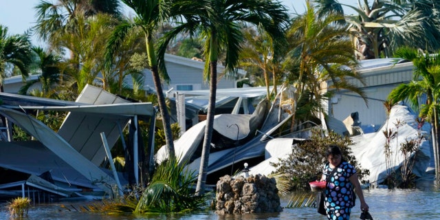
Holly Nugyn walks out of her flooded neighborhood after Hurricane Ian passed by the area Thursday, Sept. 29, 2022, in Fort Myers, Florida.
(AP Photo/Steve Helber)
FOX WEATHER: WHERE IS IAN HEADED NEXT? DANGEROUS STORM’S IMPACTS WILL BE WIDESPREAD
Hurricane conditions were possible in North Carolina’s hurricane watch area by the afternoon.
Flooding rains are likely across the Carolinas and southern Virginia, and ongoing major to record river flooding will continue across central Florida through next week.
The center of the hurricane will approach and reach the coast of South Carolina on Friday and then shift farther inland across eastern South Carolina and central North Carolina on Friday night and on Saturday.

In this photo taken by a drone, the two-story Getaway Marina building, front, lies reduced to rubble as displaced boats rest along the roadside and a trailer park, at top, lies nearly devoid of homes, following the passage of Hurricane Ian, on San Carlos Boulevard in Fort Myers Beach, Florida, Thursday, Sept. 29, 2022.
(AP Photo/Rebecca Blackwell)
Little change in strength is expected before it reaches the coast and rapid weakening is projected following landfall.
The hurricane is forecast to become an extratropical low over North Carolina on Friday night or on Saturday. The low is then expected to dissipate by Saturday night.
CLICK HERE TO GET THE FOX NEWS APP
At least 10 fatalities have been confirmed by Florida officials thus far.