Following a deadly outbreak of tornadoes in the South and Midwest on Friday, severe weather was forecast to continue on Saturday.
The National Weather Service warned of the powerful storm tracking eastward, bring the threat of thunderstorms and strong winds for the Ohio Valley, Northeast and Mid-Atlantic regions.
The agency said maximum wind gusts could approach 60 miles per hour throughout much of the Appalachians, upper Ohio Valley and Mid-Atlantic.
“Winds of this magnitude are likely to blow down numerous trees and potentially lead to widespread power outages,” it warned.
ONE DEAD, DOZENS INJURED IN THEATRE ROOF COLLAPSE IN ILLINOIS
High wind warnings and advisories were in effect.
A home in the 19000 block of Wapello Keokuk Road, about 1.5 miles southeast of Martinsburg, Iowa, was badly damaged in a severe weather storm, Friday, March 31, 2023. (Kyle Ocker/The Ottumwa Courier via AP)
This comes as severe thunderstorms were possible for the interior Northeast.
The scattered damaging winds and a couple of tornadoes would be possible across parts of that region through the evening, and the National Weather Service noted warming temperatures were expected to help lead an environment conducive to thunderstorm development from the Ohio Valley to the Northeast.
Storms would be capable of containing damaging wind gusts, large hail and a few tornadoes.
A few severe thunderstorms were also possible further to the south as a cold front reaches the Southeast.
INDIANA COUNTY SUES STATE OF EMERGENCY AFTER TORNADO

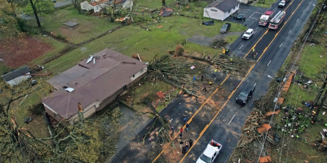
Damage to homes on E. Kiehl Ave. can be seen after a tornado caused extensive damage in the area Friday, March 31, 2023, in Sherwood, Arkansas. (Colin Murphey/Arkansas Democrat-Gazette via AP)
FOX Weather, citing officials, reported on Saturday that tornadoes in the Midwest and South were related to the deaths of at least 11 people in multiple states. Dozens more were injured.
On the cold side of the system, heavy snow and winds were expected for the Midwest and Great Lakes, and the next major winter storm is forecast to begin forming over the central Great Basin and Rockies on Monday.
Unsettled and warm weather is anticipated throughout much of the south-central U.S. and Deep South, with a warm front in the southern Plains and lower Mississippi Valley on Sunday and an approaching shortwave trough expected to produce showers and thunderstorms overnight.

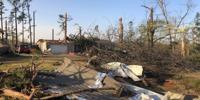
Debris covers the ground around a home that was damaged from severe weather in Wynne, Arkansas, on Saturday, April 1, 2023. (AP Photo/Adrian Sainz)
A few of related storms may lead to flash flooding concerns between northeastern Texas and central Mississippi.
Above-average temperatures are also set to build into the region by Monday; the warm weather, gusty winds and low relative humidity will produce critical fire weather conditions for the central and southern High Plains.
The Associated Press contributed to this report.