CNN
—
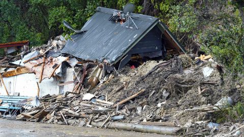
New Zealand declared a National State of Emergency on Tuesday for the third time in its history as Cyclone Gabrielle pounded the North Island with wind and rain, knocking out power to tens of thousands of homes.
Winds gusts of over 140 kilometers per hour (87 miles per hour) were recorded along the coast, with waves close to 11 meters (36 feet) high off the Bay of Islands, according to the New Zealand Meteorological Service.
Prime Minister Chris Hipkins said the full scale of the disaster only became apparent as the country woke Tuesday.
“With an event of the size and the scale that we have seen in the last 24 hours, what we have to do is make sure that we’re dealing with the most pressing needs across the country as quickly as we can,” he told reporters.
The cyclone is the second significant weather event to hit Auckland and the upper North Island in just a few weeks. Last month Auckland and surrounding areas were hit by record rainfall that sparked floods and killed four people.
This latest disaster is the third national state of emergency after the 2011 Christchurch earthquake and Covid pandemic in 2020, and is due to a weather system off the country’s north that is tracking south and east along the coast.
Overnight, 150 New Zealand Defence Force personnel joined efforts to distribute supplies and evacuate residents from areas where rising water forced some homeowners onto roofs. Electricity is out for tens of thousands of residents, and the cell service is patchy in some areas, making it hard to coordinate services and contact people left stranded.

Several communities and regions had been isolated, the Met Service said in a Facebook post. “Over 30 state highway closures and the shutdown of air, sea, and rail transport for much of the northern half of the North Island,” the post said.
Air New Zealand canceled all domestic flights to and from Auckland Airport – around 55 — for the remainder of Tuesday due to strong winds.
Napier Airport, a regional hub further south, received three times as much rain as the February average – and recorded its second wettest day ever, with 175 millimeters of rain in the 24 hours to 9 a.m. local time Tuesday, the Met Service said.
Red warnings, the highest alert level issued by the New Zealand Met Service, are ongoing and will last through much of Tuesday.
CNN Meteorologists predict another 24-36 hours of gale force winds to impact the eastern shoreline and adjacent interiors of the North and South Island before gradually tapering off by Wednesday afternoon.
Additional rainfall totals of up to 150mm can be expected across the southeastern regions of the North Island, including Wellington, through Thursday, while lesser totals will accumulate across the South Island, just north of Christchurch.